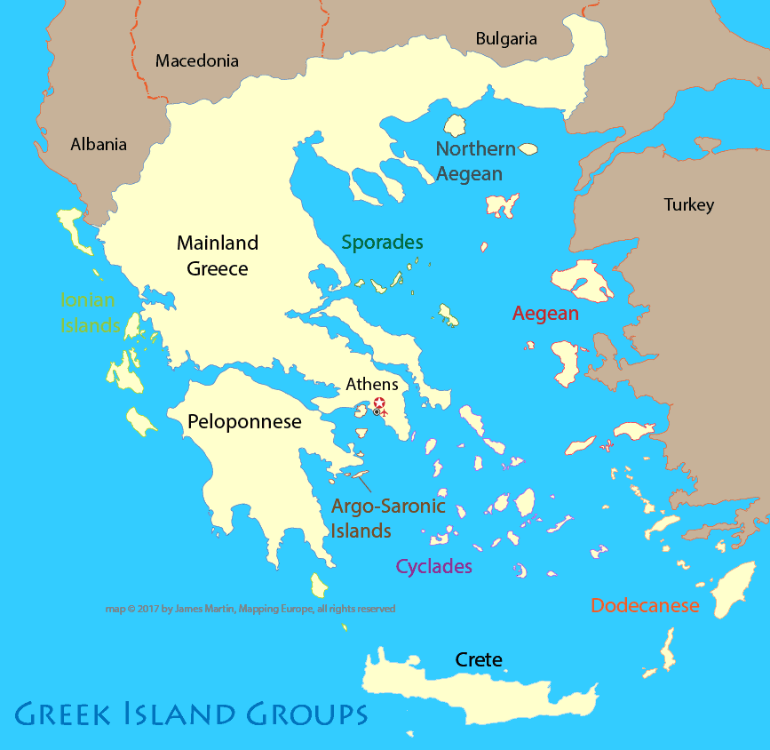
Travel sites often refer to the island groups of Greece. The map below shows the regions of Greece, including the island groups, which are color coded.
Disclosure: Content in the following sections contains affiliate links, from which we receive a small sum that allows us to bring this free content to you.
Greece Travel Toolbox
The main way to travel around the Greek islands is by ferry. The Greek mainland and Peloponnese are connected by bus and train service.
Greek Islands by size
The largest of the Greek islands is Crete, followed by Euboea, Lesbos and Rhodes. According to Wikipedia, "the rest of the islands are two-thirds of the area of Rhodes, or smaller."
The Island Groups
-
Aro-Saronic (near Athens)
-
Cyclades (popular with tourists)
-
North Aegean Islands
-
Dodecanese
-
Sporades
-
Ionian Islands